News
Google used AI and imagery to bring Immersive View for Routes to life in 15 cities

Google has introduced a new feature for routes named Immersive View, which lets you see all the information you need about your journey in a single, multidimensional view. Whether you are walking, biking or driving, Immersive View for routes will show you the weather, traffic, road closures, bike parking, and more along your route.
At the moment, the Immersive View feature of Google Maps is rolling out in 15 cities including Amsterdam, Barcelona, Dublin, Florence, Las Vegas, London, Los Angeles, Miami, New York, Paris, San Francisco, San Jose, Seattle, Tokyo, and Venice.


Immersive View for Routes
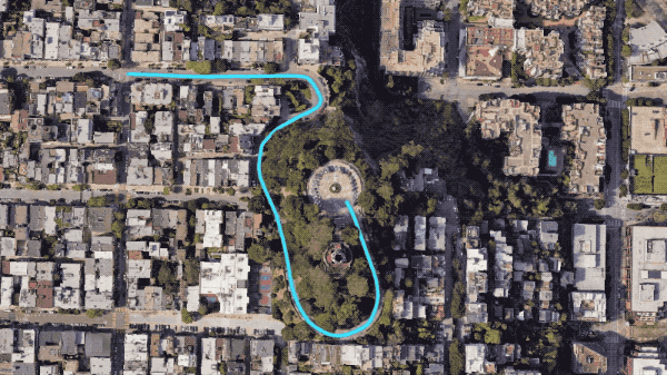
The new feature of the Google Maps app uses AI and imagery to create a realistic 3D map of the world, based on billions of high-resolution photos collected from planes, Street View cars, and Trekkers. The photos are stitched together and analyzed by machine learning models that can recognize and label objects in them, such as signs, buildings, and entrances.


The 3D map is then overlaid with a blue route line that shows you how to navigate to your destination. The route line is hidden when it goes behind or under obstacles, using a technique called occlusion. The camera moves smoothly along the route, using a mathematical construct called a B-spline, to create a smooth camera path that has a clear view of the route.

Furthermore, this feature also adds Google Maps’ trusted information, such as weather, air quality, and traffic, to help you plan your trip better. The feature uses Google Research’s analysis of historical driving trends to simulate live traffic for current and future times.